 |
| 2013 Trip Collage - click for larger size |
 |
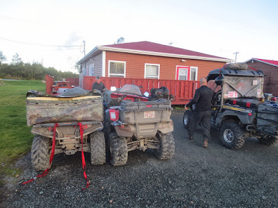
| Unloading the ATV's from the trailers. The furthest of the two ferries is the one we took |
 |
| The Yarmouth crew getting organized before loading. You can see the ferry in the background. Scott, Randy, Daniel, Kerry, Scott, Kelly and Terry |
 |
| Darryl and his Grizzly are ready to board |
 |
| Bruce's boarding pass |
 |
| Waiting to board the Atlantic Vision |
 |
| Boarding the boat... the adventure begins! |
 |
| Grabbing my over-night bag before going to the main deck. Once upstairs you can't return to the vehicles until you arrive in NL. |
 |
| View from the main deck - we had good weather most of the trip. |
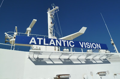 |
| Atlantic Vision is Marine Atlantic's largest and most luxurious ferry to make the crossing. It's the only one that makes the 15 hour Argentia run. |
 |
| Hanging out in the games room |
 |
| Darryl, Mike and Bob taking pictures of the ocean sunset |
| Day2 Saturday September 7: Argentia, NL to Clarenville, NL See the detailed GPS track here. Time: 8 hrs - 10 minutes 10:40 trail start (3.1 km from ferry) 18:50 Clarenville - St. Jude's Hotel Distance: 146.4 km (90.96 miles) Fuel: Gas stop at 115 km (71.5 miles) 14.73 litres (3.9 gallons) avg 12.8 l/100 kms (18.37 mpg) Days Costs$33.20 for Hotel Supper $21.00 gas $68.37 St. Jude's Room (per person per double occupancy) $$$ Miscellaneous approx total $130.00 |
It was the first day on the trail and the weather was fantastic. It was long but we took our time, stopped for photos and explored on foot. Overall it was a great first day and everyone had a good time. We ate at the Hotel restaurant for supper and gathered in one of our rooms for drinks. |
 |
| Bob, Daryl, Bruce and Murray take in the scenery while docking |
 |
| "Bob Squishing" |
  |
| Taking a moment to get organized at the start of the trail |
 |
| The first picture of the trail |
 |
 |
| There was a lot of water on the first 30 km (18 miles) of trail due to heavy rain the week before. This much water is unusual. It looks worse than it was. |
 |
| A trail break |
 |
| I was able to pack a lot in my home made storage box. |
 |
| One of many tunnel crossings under Provincial Highways. |
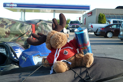 |
| Another pit stop - Moosey, and I, opted for a set of Red Bull Wings |
 |
| Moosey's long lost relative |
 |
| This part of the trail had a lot of flat lands. There was a lot of different types of scenery during the week. I loved it all. |
 |
| Midday sun |
 |
| One of the inuksuk's we came across |
 |
| setting up a tripod shot |
 |
| The tripod shot! |
 |
| Another Tripod Shot |
 |
| Arriving at St. Jude's Hotel. We parked out back next to our rooms. They had a great restaurant. |
Day 3
Sunday September 8: Clarenville to Gander See the GPS track here. Time: 9 hrs 40 mins 09:30 - Trail start 19:10 - Arrived Gander Distance: 146.1 km (90.78 miles) Gas stop - 38.9 km (24.17 miles) we fill up whenever we can 7.62 litres (2.83 US gallons) avg 10.74 l/100 kms (21.9 mpg) Days Costs$15.53 Motel breakfast $10.89 gas $65 per person for Frosty's trailside Motel $22.08 for supper and at Rosie's restaurant $$Miscellaneous approx. total $120.00 |
Our second day on the trail and again, the sky was blue and the sun was shining. We stopped frequently to take pictures and we found a waterfall we explored for about an hour or so. We also stopped at a pub in Gambo, and navigated around a few washouts. This added to the time required to complete the day's journey. If you don't stop as much as we did you could finish quicker - but you'll miss the scenery! |
 |
| Bright eyed and bushy tailed for another day on the trail |
 |
| We stopped and explored this waterfall for over an hour. Turns out there were two other waterfalls above and behind it. |
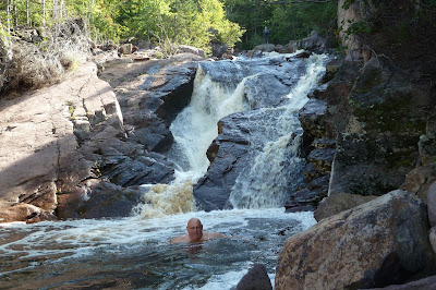 |
| Mike had to jump in and test the water at waterfall 1 |
 |
| Waterfall 2 |
 |
| Waterfall 3 |
 |
| The Third waterfall, Murray said the water was great |
 |
 |
| Stopping at the bridge at Terra Nova National Park |
 |
| A view of the falls from the bridge |
 |
| A nice find in the Town of Gambo. We stopped for a beer before hitting the trail again. |
 |
| Our first major washout |
 |
| Our second major washout. See the video below of how we got around it. |
 |
| We met up with the Yarmouth crew and spent the night at Frosty's. As of 2016 they are all booked every night with construction crews. Stay at the Comfort Inn instead. |
| Day 4 Monday September 9: Gander to Badger See the GPS track here. Time: 6 hrs 45 minutes 10:00 start in Gander (after gassing up) 16:45 arrived in Badger Distance: 137 kms (85.12 miles) Fuel: gas stop before we started out 12.2 litres (3.22 US gallons) gas stop at 101 km (62 miles) 11.5 litres (3.03 gallons) Days Costs $65.00 Trailblazers motel $12.61 breakfast at Rosie's restaurant $17.44 gas $16.74 gas $15.00 bbq food for supper $$miscellaneous - snacks, beer etc. approx. total $140 |
The third day on the trail was as beautiful as the two previous days. We didn't take as many photos as previous days and only stopped for a BBQ lunch, gas, and when we arrived in Badger. This was one of the shortest travel days we had and there were lots of long stretches where we averaged 55 - 65 km/h (35-40 mph). |
 |
| Rosie's is a restaurant in Gander, right on the trail. Check out the Map on the first page on the blog to see it. Friendly staff and great food! |
 |
| We got some supplies at the Wal Mart in Gander before hitting the road |
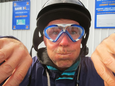 |
| Bruce bought swimmers goggles to keep the dust out of his eyes. They worked great. |
 |
| A friendly local that approached us during a pit stop (in the middle) |
 |
| Apparently Newfoundland is committed to improving the trail. Some sections definitely need some work but are passable. |
 |
| Unfortunately we saw quite a few vehicles in certain sections |
 |
| One of several long straight sections encroached with brush |
 |
| Another BBQ lunch break on the trail. |
 |
| Burgers and hotdogs all around |
 |
| The road on the right is a path to an Irving Gas Station |
 |
| Arriving in Badger - Trailblazer's was just down the trail about 1 km (.6 miles) |
 |
| We stayed here and took several pictures and enjoyed the sunshine before heading to Trailblazers and making supper |
 |
| Bob and Murray |
 |
| Bruce and Murray |
 |
| Darryl wearing the Wolf Snout to keep the dust out |
 |
| Patrick enjoying the sun and the break |
 |
| Bruce, Murray and Bob |
 |
| Trailblazer's Efficiency Units. It's a great spot with large common area, kitchen, and washer and dryer that came in handy. I took this picture from the trail. |
 |
| Darryl plugged my punctured tire in about five minutes. It was the only tire issue for any of us the entire trip. The air compressor came in handy. |
Day5
Tuesday September 10: Badger to Deer Lake
See the GPS track here.
Time:
10:00 started the day
17:52 arrived at Deer Lake - Driftwood Inn
10:00 started the day
17:52 arrived at Deer Lake - Driftwood Inn
approx 8 hours (including a few hours for stops)
Distance:
133 km (83 miles)
133 km (83 miles)
Fuel:
gas stop before we left
4.9 litres (1.3 US Gallons)
gas stop at Howley after 105 km (63 miles)
12 litres (3.17 US gallons)
12 litres (3.17 US gallons)
top up at Deer Lake
6 litres (1.58 US gallons)
$7.00 gas
$17.16 gas
$17.16 gas
$8.66 gas
$58.76 Driftwood Inn
$28.58 supper at Motel
$28.58 supper at Motel
$$ miscellaneous
approx total $130
Approx 8 hours of great riding with sunshine all day. Temp was about 22C (71 F). We stopped at the granite quarry, gaff topsail, and the beaches at Howley area. We took tons of photos this day.
 |
| The fourth day on the trail |
 |
| Sunrise in Badger. I took this picture walking back to Trailblazers after buying some breakfast grub at a nearby store. |
 |
| filling up at the Badger Irving before hitting the trail |
 |
| The granite quarry. Our group of six met up with the Yarmouth group of 10 for photos. |
 |
| The bottom of the Gaff before we made the ascent. See the video below. |
 |
| The view from the top of the Gaff |
 |
| Both groups making lunch |
 |
| Big Mike's happy pose |
 |
| Darryl heats the beans |
 |
| The beaches in Howley |
 |
| Another beach at Howley - See the video below to see more of the beach areas |
 |
| Mike and Bob went for another swim |
 |
| The Dam at Deer Lake |
 |
| the top of the dam |
 |
| Getting our bearings on a local snow mobile map |
 |
| Pointing out the final destination for the day |
 |
| The Driftwood Inn rear parking lot is right off the trail |
 |
| The Driftwood Inn pub |
Wednesday September 11: Deer Lake to Robinson's
See GPS track here.
Time:
09:15 ATV's picked up by Towing company to by pass the gap in the trail
10:30 Transport to Logger School Road by towing company
12:10 Arrived Serpentine Lake for lunch
13:30 Left the lake
18:50 Arrived at Robinson's
10 hours approximately
Distance:
173 km (107 miles)
Fuel:
gas stop at 16:00
14.126 litres (3.73 US gallons)
14.126 litres (3.73 US gallons)
$20.20 gas
$40.00 for tow trucks
$5.20 Burger King Breakfast - don't laugh the pancakes were great.
$12.00 supper at Pirate's Haven
$40.00 for tow trucks
$5.20 Burger King Breakfast - don't laugh the pancakes were great.
$12.00 supper at Pirate's Haven
$108.25 Pirate's Haven Chalets. (3 people per chalet)
$$miscellaneous
approx total $200.00
$$miscellaneous
approx total $200.00
This was a long day and it rained hard pretty much all day but luckily the temperature was warm. Everyone seemed to have a fantastic time despite the weather.
 |
| Early morning breakfast at Burger King - the pan cakes were good. |
 |
| getting our atv's packed on tow trucks to cover the gap in the trail |
 |
| Arriving at Logger School Road. It leads back to the T'Railway. |
 |
| arriving at Serpentine Lake |
 |
| Serpentine Lake - Too bad it was clouded over that day |
 |
| Making use of the tarp to keep the rain off |
 |
| Arriving at the Pirate's Haven Chalets main office/bar/restaurant. |
 |
| The bar |
 |
| Fresh cod dinner was an especially nice touch after our long day of rain. |
 |
| One of the Pirate's Haven Chalets we rented. It was very comfortable spot with great service and food! |
 |
| The view of the trail from the Chalets |
 |
| Aerial view of the Pirate's Haven Chalets (taken from their website) |
Thursday September 12: Robinson's to Port Aux Basques
See GPS track here.
Time:
12:15 start
19:25 end of trail (ferry terminal was about 5 minutes away)
19:25 end of trail (ferry terminal was about 5 minutes away)
7 hours - including side excursion to the Table Mountains
Distance:
130 km (80 miles)
Fuel:
top up before we left
7.386 litres
$42.25 adult ferry ticket
$55.61 ATV cost for ferry
$61.35 per person for 2 bunk room
$9.50 ferry breakfast
$10.00 bbq supper food (we had in the parking lot while waiting to load onto the boat)
$$miscellaneous
approx. total $160
About another $200 for truck gas, parking, and other miscellaneous items
We didn't have far to go this day so we left around noon and stopped several times for photos and explored the Table Mountains. It was over cast but it didn't rain and the temperature was warm.
 |
| Bruce, Bob and Mike enjoyed the hot tub at the Chalets before hitting the trail. |
 |
| Topping off with fuel at Salt Water Joyz (used to be Pirate's Hideaway) |
 |
| A waterfall on the Table Mountains - We searched for a trail that might have led up there but couldn't find one. |
 |
| Exploring a side trail |
 |
| Crossing a river for the hell of it |
 |
| Some of us made the climb to the top of the Table Mountains. Too bad it was clouded over and we couldn't see anything. |
 |
| The view (or lack of) from the top of the table mountains |
 |
| Bruce negotiates his way back down the mountain |
 |
| Mike and Bob went to another mountain and it wasn't shrouded in mist like the other one. |
 |
| One of the many beautiful lakes close to Port Aux Basques |
 |
| One of the many beaches on the opposite side of the trail from the lake in the above picture |
 |
| Panoramic with Darryl - click to see larger view |
 |
| The end/start of the trail on the Port Aux Basques side |
 |
| The mandatory spray down before getting on the ferry |
 |
| Later while waiting to board we fired up the bbq and had some sausages in the parking lot. |
Day 8 - Arriving in Nova Scotia and the drive home
I had a 3 hour drive. The rest of our group had about a 4 hour drive and some of the Yarmouth group had a 7 hour drive to get home.
 |
| The trip completed and packing up to head home |
 |
| Our Yarmouth buddies caught hands-up fever |






Looks like a nice ride. The wife and I recently did the ride from Stephenville Crossing to Port-Aux-Basques and return the next day. Nice ride.
ReplyDeleteYeah it's a lot of fun. The part of the trail you did is one of my favourite sections.
DeleteAll looks great did the trip in 05 Enjoyed it ! Great pic;s!!
ReplyDeleteI'm thinking of making a solo ride on my dual-purpose motorcycle this summer (2014). This gives great insight; pictures and commentary are very helpful. Thanks!
ReplyDelete